This will be my first hiking blog because I wanted to write about it. I have a couple of tech articles lined up especially after picoCTF 2026 and I just started getting more into automation (packer, terraform, k8s…. etc).
Basic Info
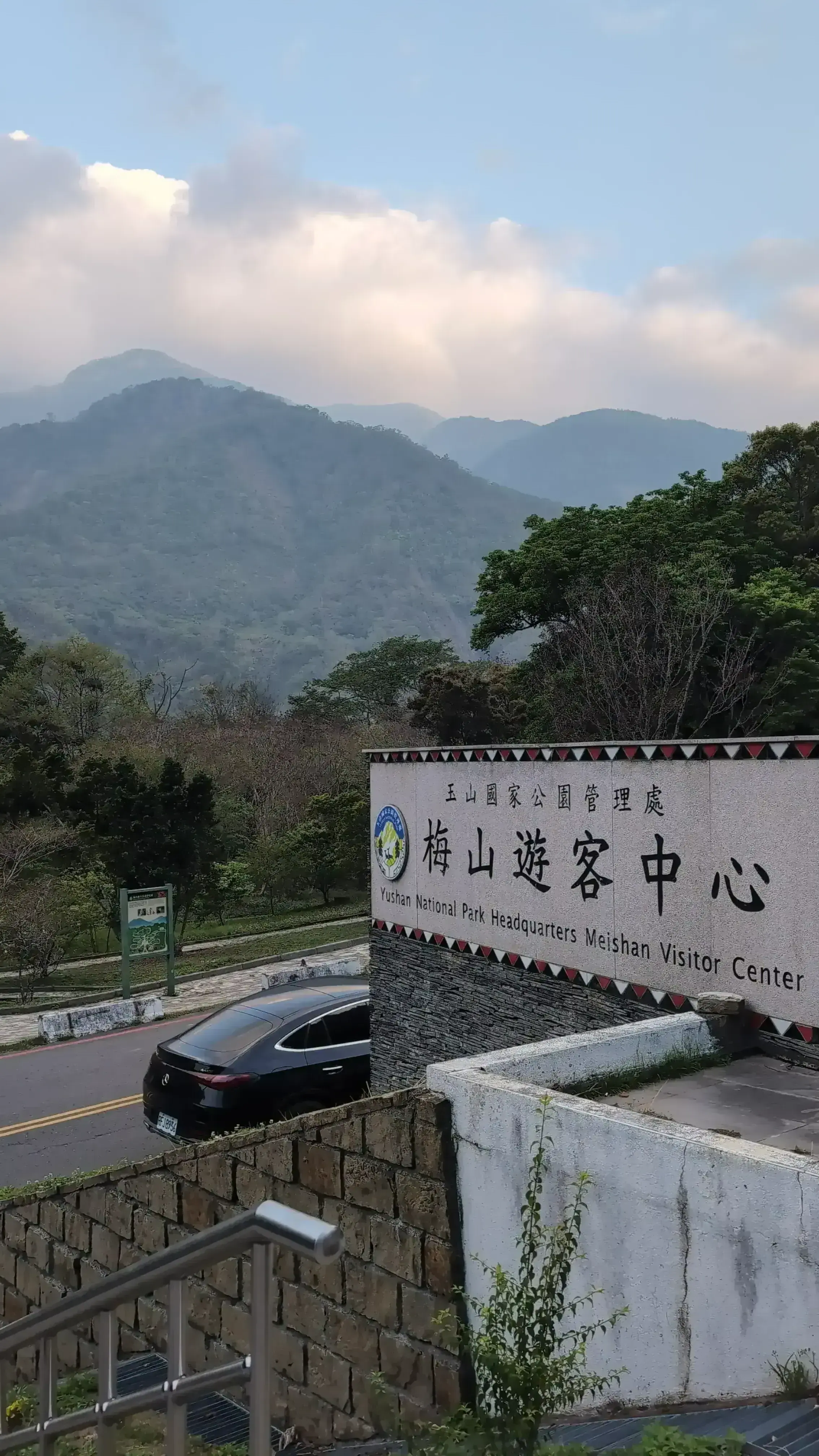
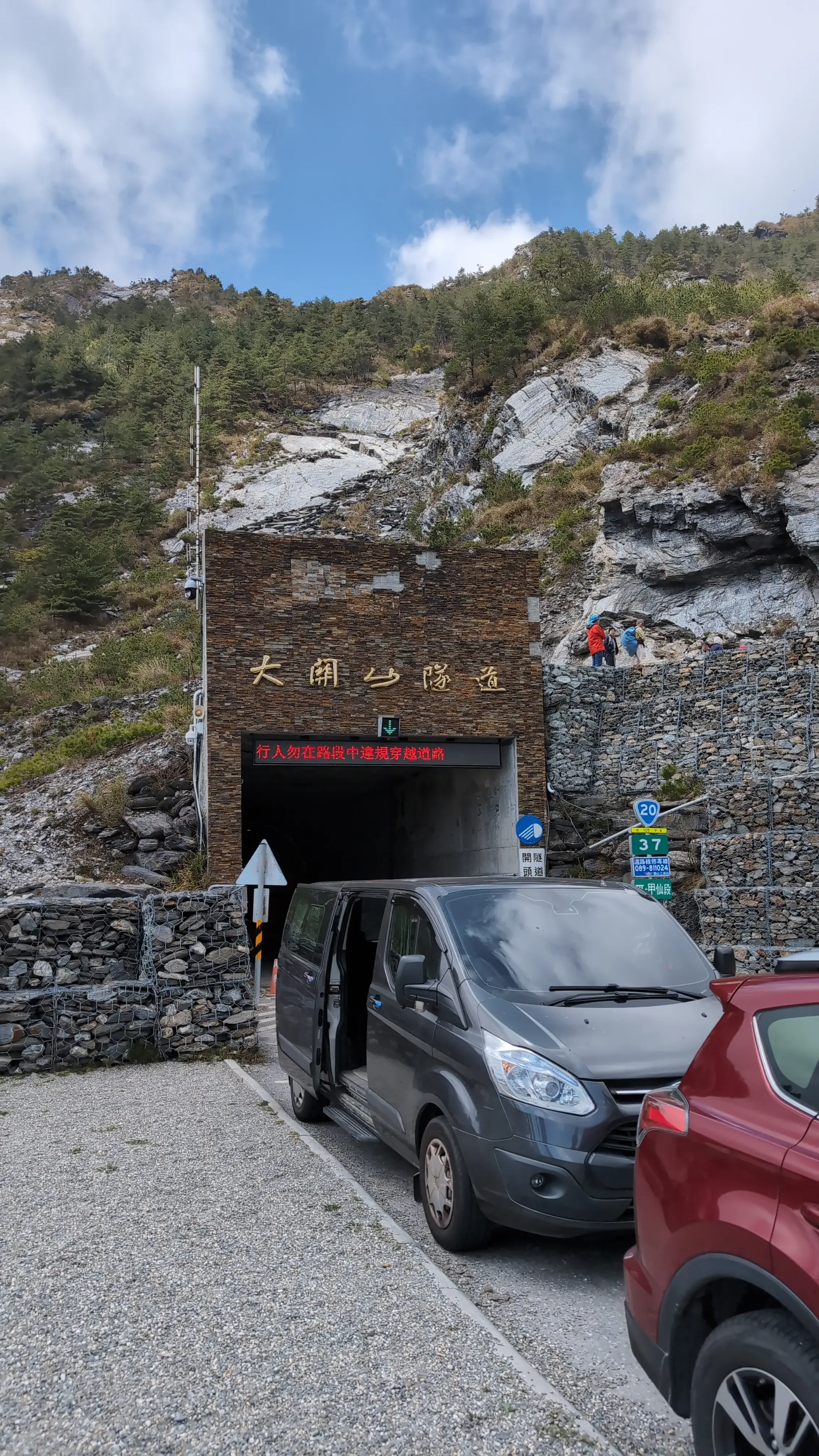
On 3/29 I went on a hike to 南橫三星, which translated is The Three Southern Stars. The peaks we got to were: 塔關山 (Taguanshan) and 關山領山(Guanshanling). These peaks are relatively easy to hike, the difficulty is in the drive up there.
Our plan was:
- 7AM: Meet at 南橫管制站(maps)
- 8AM: Get to trailhead of 塔關山 (Taguanshan) and start hiking
- 11:30AM: Get back to trailhead of 塔關山 (Taguanshan)
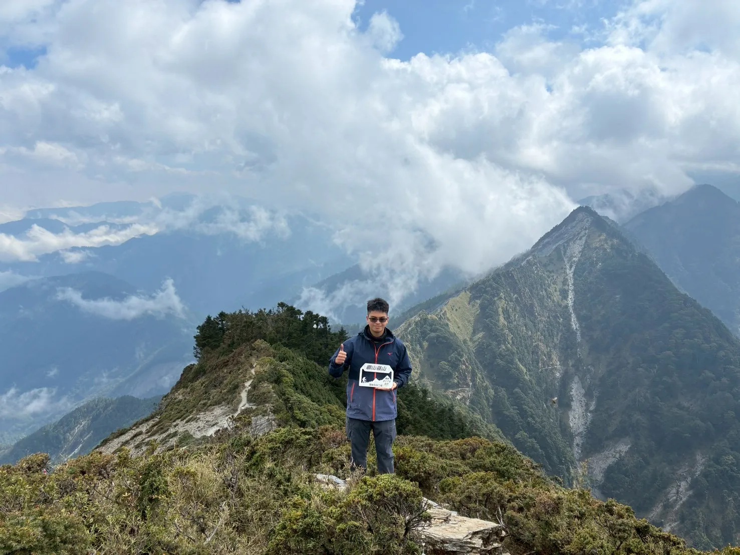
- 12PM: Get to trailhead of 關山領山 (Guanshanling) and start hiking
- 3PM: Return to trailhead of 關山領山 (Guanshanling)
- Before 5PM: return back to 南橫管制站(maps)
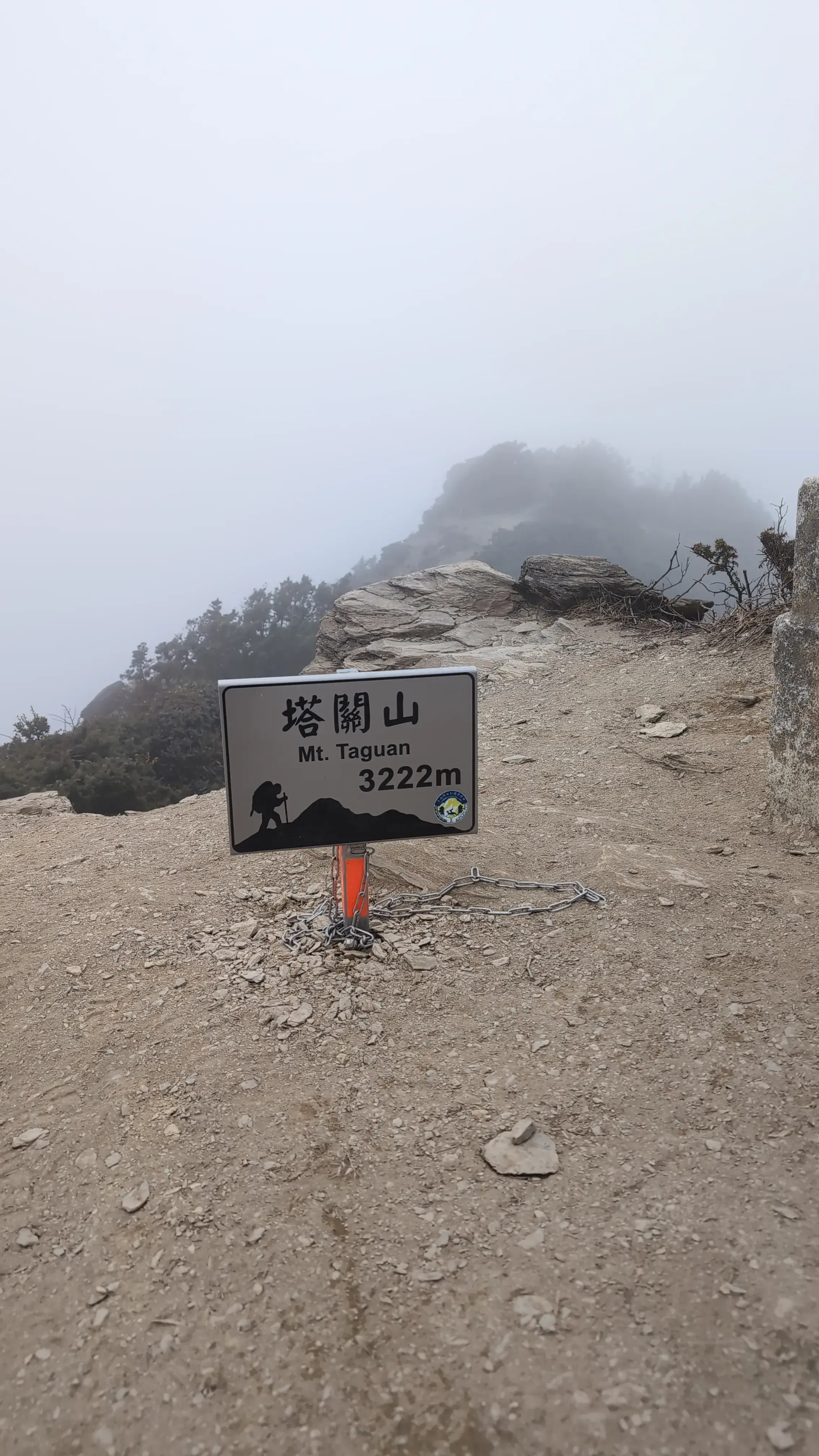
塔關山 (Taguanshan)
We started from this trail because it was easier to find parking here. This mountain’s peak is at 3222m sea level and the trail starts from 2580m. The trail itself is 2.2km ascent and 2.2km descent, a relatively easy hike but pretty steep (642m). We took roughly 1 hour 53 minutes to get to the top, and 1 hour 47 minutes to get back down. In total, around 3 hours and 38 minutes.
During this hike, it had rained a little the day before so the ground was slippery and hard to navigate. Terrain wise, this was one of the harder ones to walk. It’s quite similar to the trail near the top of 北大武(Beidawu). Lots of roots to grab on to, lots of steep terrain.
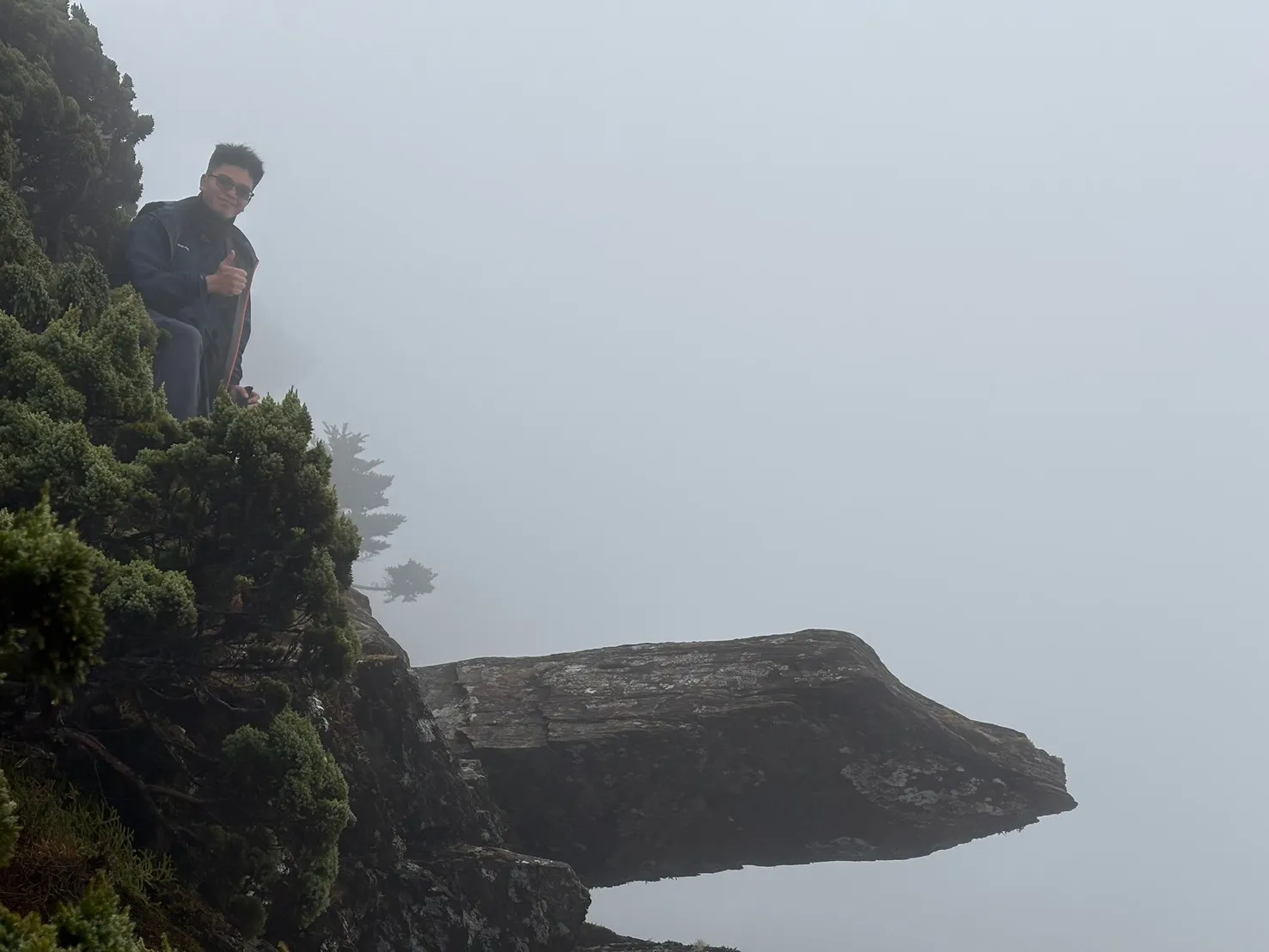
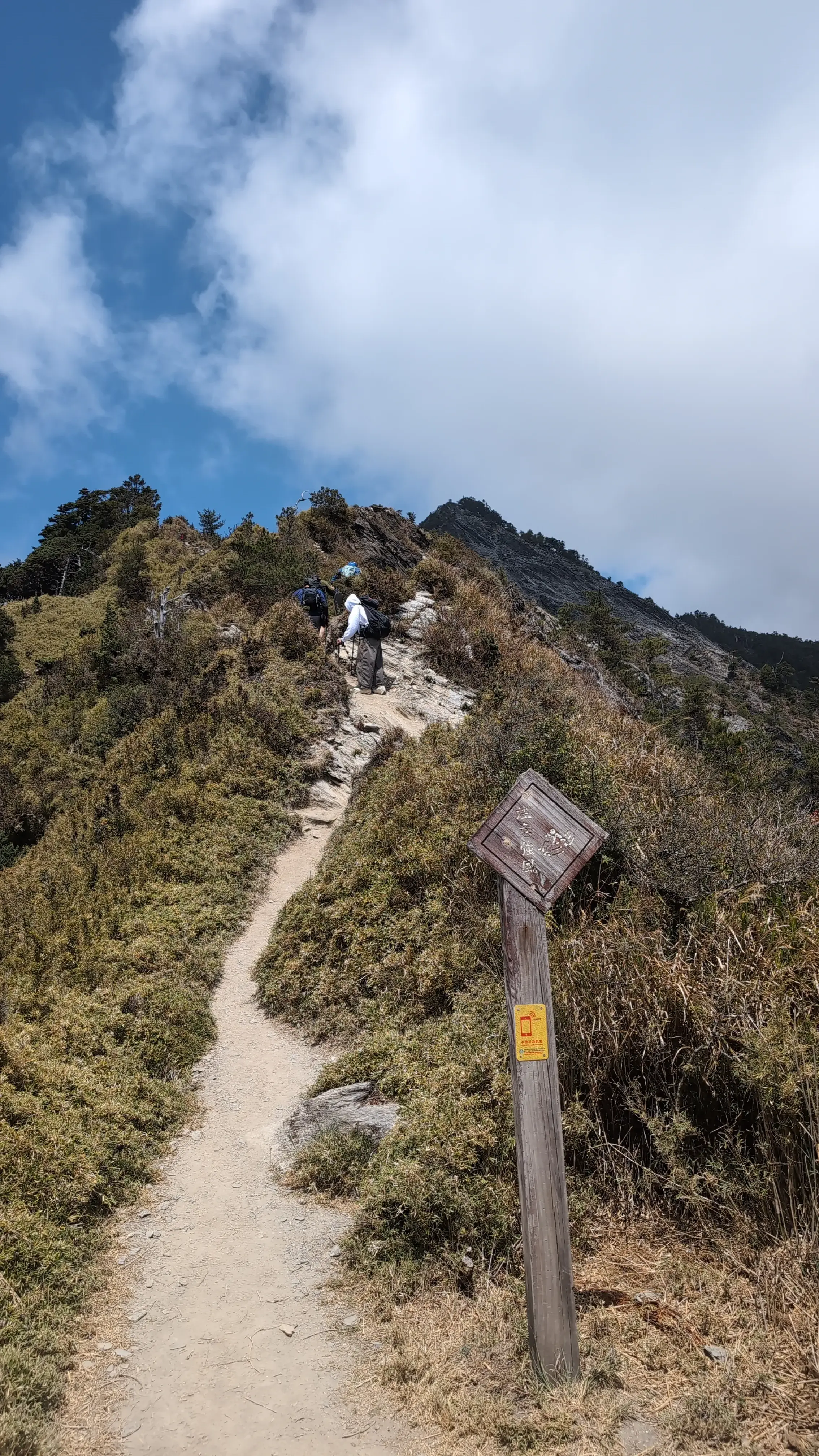
If you enjoy the scenary of being in a forest, this hike is quite beautiful. If not, and you prefer the scenary of vast mountains and clouds, then it would be worth it to get to the top. We were unfortunate enough to only see a wall of white around us at the top. I think if we went later in the day then we would’ve had a much better view.
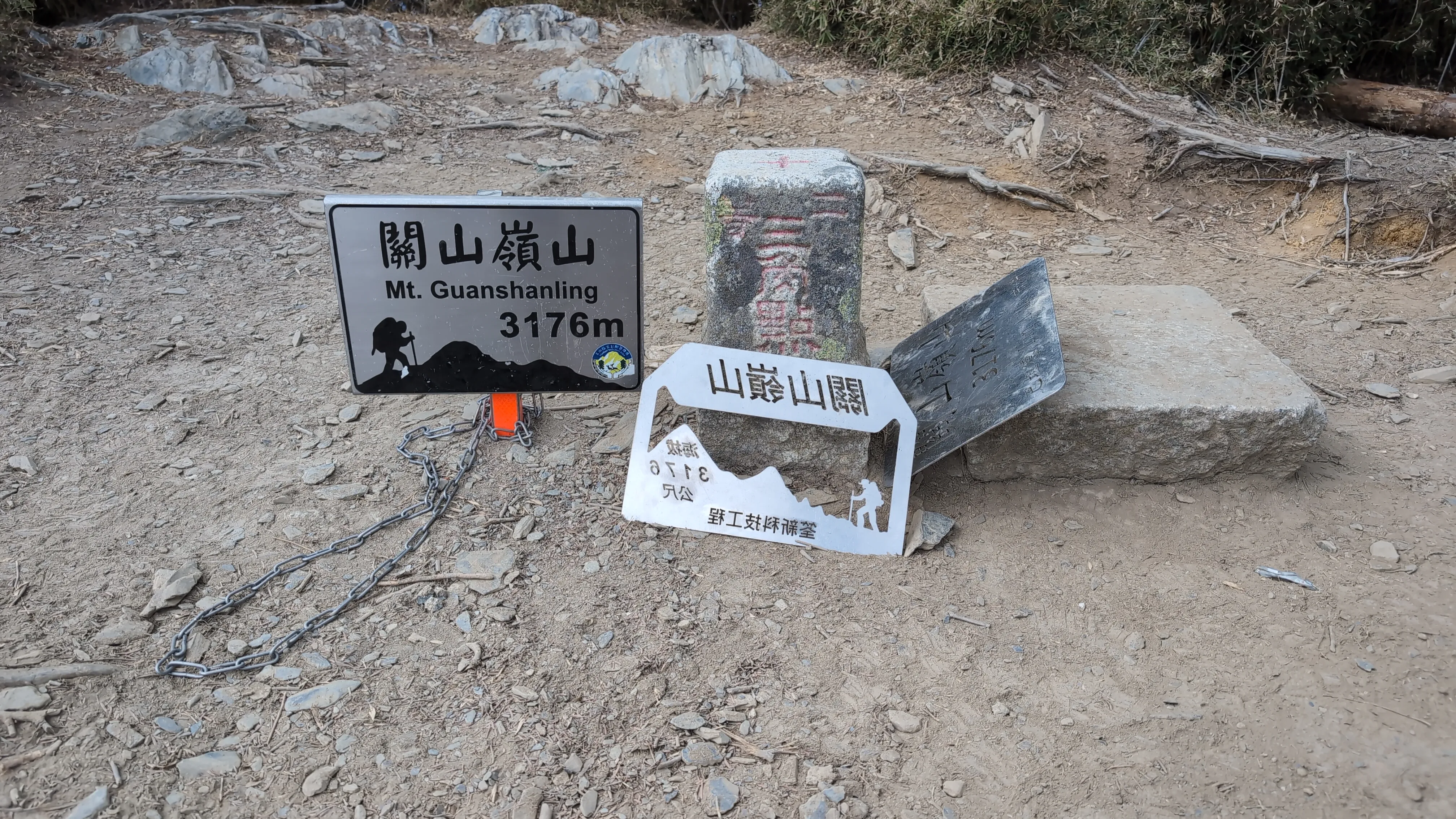
關山領山 (Guanshanling)
The parking for this mountain was more formalized but there were less spaces because you couldn’t just park on the side of the road. The peak at 關山領山(Guanshanling) is 3176m, starting from 2733m. The trail is 1.5km so 3km in total, but a steep incline of 443m. It took us 1 hour and 30 minutes to get to the top of this one and another 1 hour and 30 minutes to get down. In total: 3 hours.
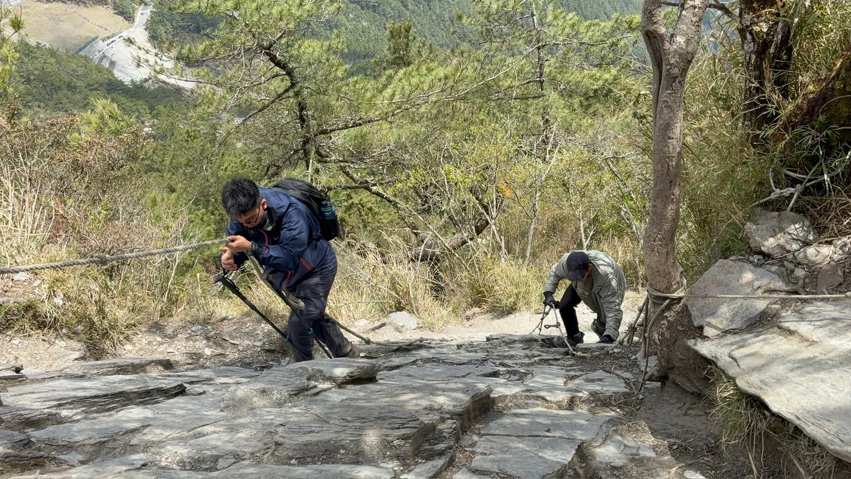
The difficulty in this mountain is that there is nowhere to stop. Every road is narrow so when trying get around others, there is almost no space. If we wanted to rest there were very few places to rest. There are also many places with steep rocky terrain, around 70 degrees. My buddy enjoyed the rock climbing aspect of the mountain but if you don’t, you can always use the ropes they provide.
The scenary here was much better because almost the entire hike if you look around you’ll see vast mountain ranges. Unfortunately because the trail was so dusty and rocky, my eyes were mostly filled with sand. I think I would’ve enjoyed the rock climbing aspect more if I wasn’t dying from light acute mountain sickness.
Gallery
My Difficulties and Challenges
While this hike should’ve been an easy and fast one, a few factors made me want to die the whole time.
- Poor quality sleep
Although I had 7 hours of sleep, they were poor quality because I kept waking up in the middle of them. Sleep is a crucial part of how I perform on hikes. If I sleep well, I basically have no pain points the day of the hike. If not, I will feel like I’m dying the entire day.
- Immediate elevation gain
Since I started in Tainan, I was going from an sea level of almost 0m up to 2500m in one day. I took diamox the day before but I don’t think it completely voided the affects of acute mountain sickness.
- The drive
From Tainan to the traffic station, it takes roughly 2.5 hours. To be safe, I wanted to wake up at 3:30AM so I could make breakfast and acclimate to waking up before the hike. If I wanted to be there on time, I would have to leave at 4:30AM. Unfortunately I woke at 3AM and couldn’t go back to sleep so I left earlier at 4AM. I rode my scooter up to the mountain for 2 and a half hours, killing any excitement I had when I woke up. I think the ride to the mountain was what messed me up because riding a scooter for that long in the cold really tires me out.
Reflection
This hike is 100% worth it, it was beautiful and fun. Next time though, probably drive up there and sleep in the car.
>> Home